


N.J. weather: Severe thunderstorms, flash flooding, isolated tornadoes could slam state today, along with bad air quality
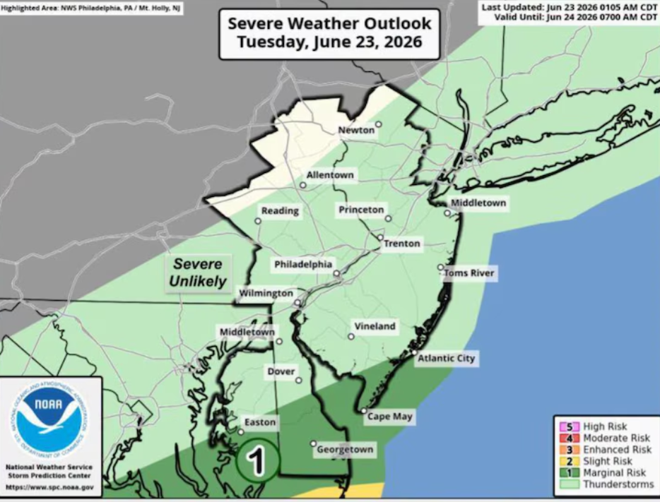
New Jersey Faces High Risk of Severe Storms, Flash Flooding, and Poor Air Quality Through Saturday
New Jersey residents are being urged to prepare for a dangerous mix of severe weather and unhealthy air conditions as multiple rounds of showers and thunderstorms are expected to move across the state throughout Saturday. Weather conditions could become hazardous in many areas, with forecasters warning of heavy rainfall, flash flooding, damaging wind gusts, frequent lightning, and the possibility of isolated tornadoes.
The severe weather threat is expected to increase from late Saturday morning and continue through the evening as widespread thunderstorms develop across the Garden State. While a few showers have already reached southern parts of New Jersey, the strongest storms are forecast to impact much of the state later in the day.
Heavy rainfall remains one of the biggest concerns. Forecasters say some thunderstorms may produce between 2 and 3 inches of rain in less than two hours. Such intense rainfall could quickly overwhelm drainage systems, causing roads, highways, and low-lying areas to flood in a short period of time. Drivers are advised to stay alert and avoid traveling through flooded roadways if conditions worsen.
Because of the flooding risk, most of New Jersey is under a Flood Watch from 10 a.m. Saturday until 2 a.m. Sunday. A Flood Watch means weather conditions are favorable for flash flooding, and residents should closely monitor forecasts and be ready to take action if warnings are issued.
In addition to flooding, some thunderstorms may become severe enough to produce damaging wind gusts capable of bringing down tree branches and causing scattered power outages. Meteorologists also warn that a few of the strongest storm cells could generate isolated tornadoes. Although the tornado threat is considered limited, it remains possible anywhere across the state where the most intense thunderstorms develop.
Frequent lightning will also accompany many of the storms, creating another safety concern for anyone spending time outdoors. Residents are encouraged to move indoors immediately if thunderstorms approach and avoid open areas until conditions improve.
Alongside the severe weather, New Jersey is also dealing with deteriorating air quality. Overnight changes in wind direction carried additional smoke, soot, and fine particles from ongoing wildfires burning in Ontario, Canada. As a result, air quality worsened across much of the state late Friday night and into Saturday morning.
The air quality reached levels considered unhealthy for everyone, not only individuals with asthma, respiratory illnesses, or weakened immune systems. While conditions are expected to improve somewhat later in the day, air quality is still forecast to remain unhealthy for sensitive groups, including older adults, young children, and people with asthma or other breathing conditions.
Residents who are sensitive to poor air quality may consider limiting prolonged outdoor activities until conditions improve. Monitoring local weather updates throughout the day is also recommended as storm timing and intensity may change.
Saturday’s forecast combines several weather hazards at once, making it one of the more active weather days for New Jersey. With the potential for flash flooding, damaging thunderstorms, isolated tornadoes, and unhealthy air quality occurring during the same period, residents are encouraged to remain weather-aware, monitor official alerts, and be prepared for rapidly changing conditions.
Sources
- National Weather Service (Official U.S. Government Weather Authority)
- U.S. Environmental Protection Agency (EPA) Air Quality Index (Official U.S. Government Source)

