


New Jersey Braces for Dangerous Heat, Storm Risk, and Wildfire Smoke in Challenging Midweek Forecast
New Jersey is expected to experience a difficult day of weather on Wednesday as extreme heat, the threat of severe thunderstorms, and smoke from Canadian wildfires combine to create hazardous conditions across the state.
Forecasters are warning residents to prepare for temperatures climbing into the upper 90s, with some areas expected to reach nearly 100 degrees. When humidity is added, it will feel even hotter, with heat index values ranging from 100 to 109 degrees in many locations. Officials are urging people to take the heat seriously, as prolonged exposure can increase the risk of heat-related illnesses.
The National Weather Service has issued Extreme Heat Warnings from 10 a.m. through 8 p.m. for Burlington, Camden, Gloucester, Mercer, Middlesex, Monmouth, Ocean, and Somerset counties. Heat Advisories remain in effect for the rest of New Jersey, highlighting the widespread nature of the dangerous temperatures.
Even coastal communities are not expected to find much relief from the heat. Along the Jersey Shore, afternoon temperatures are forecast to reach the mid- to upper 90s. Combined with high humidity, conditions could feel like 100 to 105 degrees, making outdoor activities uncomfortable and potentially dangerous.
Beach visitors should also be aware of hazardous ocean conditions. A high risk of dangerous rip currents is forecast for Jersey Shore beaches, increasing the risk for swimmers entering the water. Officials recommend following local beach safety guidance and paying close attention to warnings from lifeguards and emergency personnel.
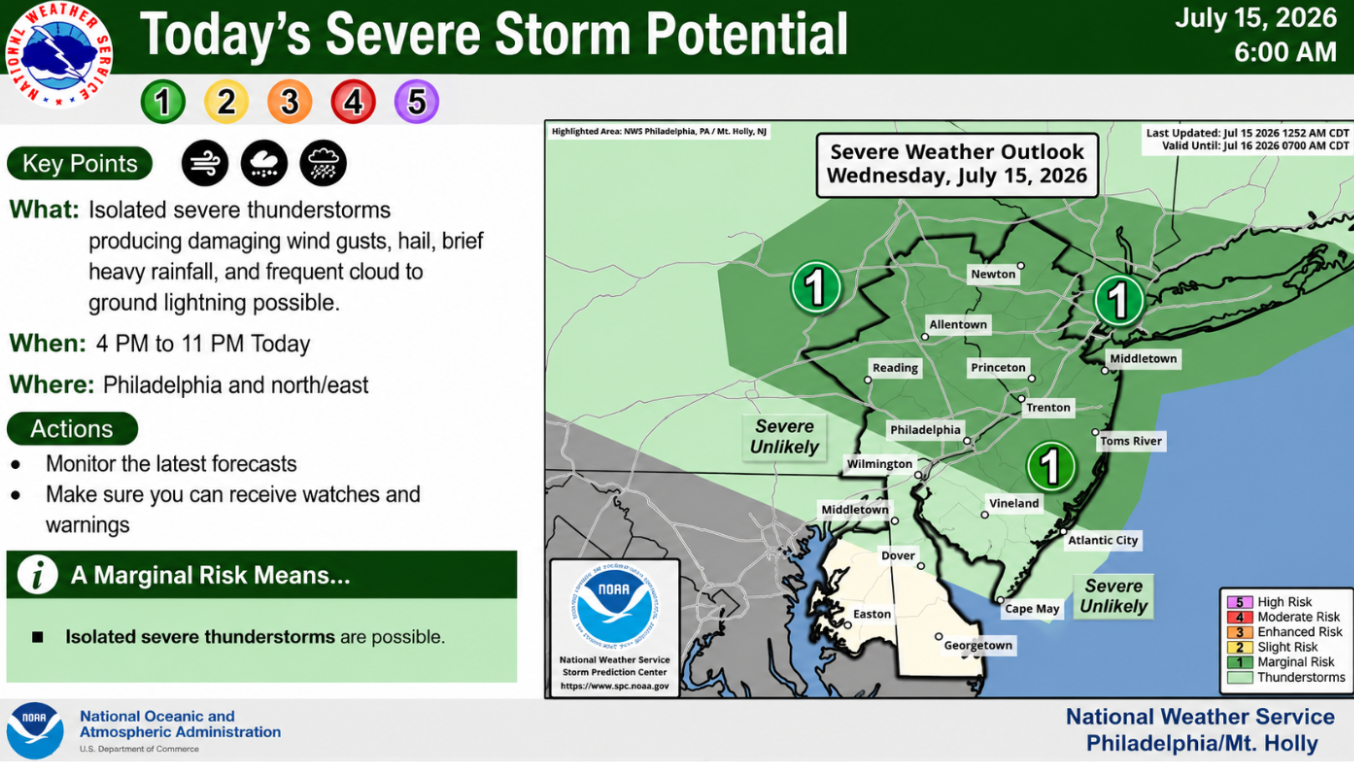
In addition to the extreme heat, weather conditions are expected to become more active later in the day. A cold front is forecast to move across New Jersey from late afternoon into the evening, creating favorable conditions for isolated to scattered thunderstorms.
The primary concern with these storms is the potential for damaging wind gusts, although hail is also possible in some areas. Most of the state has been placed under a Level 1 of 5 risk for severe weather, indicating that while widespread severe storms are not expected, isolated storms could become strong enough to produce hazardous conditions.
The hottest temperatures on Wednesday are expected to come close to long-standing daily records for July 15, although current forecasts indicate that existing records are likely to remain intact. Areas around Trenton and Atlantic City could come nearest to matching historical highs.
Following the passage of the cold front, another weather concern is expected to develop. Smoke from Canadian wildfires burning in western Ontario is forecast to move into the region beginning Wednesday night and continue afterward. The wildfire smoke may reduce air quality and create additional concerns, particularly for people with respiratory conditions or those who are sensitive to smoke exposure.
With several weather hazards expected within a single day, residents are encouraged to stay informed about the latest forecasts and weather alerts, limit strenuous outdoor activities during peak afternoon heat, and remain prepared for changing conditions if thunderstorms develop later in the day. Monitoring official weather updates will be important as the situation evolves throughout Wednesday.
Sources
- National Weather Service (NWS)
- National Oceanic and Atmospheric Administration (NOAA)

