
Heat Surge in New Jersey to Trigger Severe Thunderstorm Risk and Damaging Winds on Thursday
New Jersey is heading into a midweek weather pattern that starts calm but quickly turns more unstable, with forecasters warning that Thursday could bring strong thunderstorms and damaging wind gusts across the state.
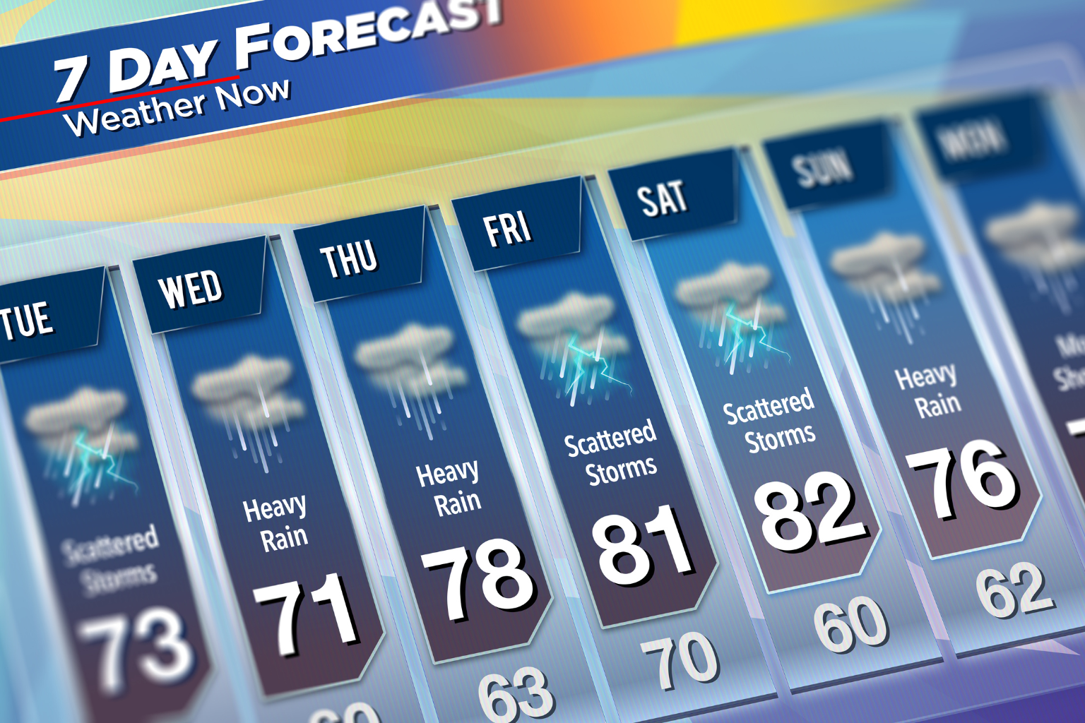
The week begins with stable and pleasant conditions on Tuesday. Residents can expect clear skies, dry weather, and comfortable temperatures ranging from the mid to upper 70s. No significant weather disruptions are expected during the day, making it one of the calmer periods of the week.
By Wednesday, the weather pattern begins to shift. A warm front will move across New Jersey, bringing increasing humidity and unsettled conditions. Scattered showers and isolated thunderstorms are expected during the afternoon and evening hours, especially in northern parts of the state. Temperatures will rise into the upper 70s and low 80s, adding to the muggy feel in the air.
The most significant change is expected on Thursday. Temperatures are forecast to climb sharply into the upper 80s and possibly reach the mid-90s in some areas. This surge in heat and humidity will create conditions favorable for strong storm development later in the day. A cold front moving in will act as the main trigger for thunderstorms across the region.
Forecasters are closely monitoring the situation due to the potential for severe weather. Wind gusts may increase throughout the day even before storms develop, with speeds reaching around 40 mph possible in some areas. During thunderstorms, wind gusts could become significantly stronger, with some forecasts suggesting they may reach between 60 and 70 mph. The primary concern remains damaging straight-line winds associated with these storms.
Weather authorities, including the Storm Prediction Center, have placed all of New Jersey under a slight risk level for severe weather on Thursday. While this is not the highest alert level, it does indicate that conditions are favorable for isolated severe storms capable of causing damage.
There is still some uncertainty regarding the exact timing and intensity of the cold front, which means storm development may vary across different regions of the state. Some areas could see more active weather than others depending on how the system evolves.
Looking beyond Thursday, additional showers and thunderstorms may continue into Friday before conditions gradually stabilize. Temperatures are expected to remain warm, staying in the 80s, but humidity levels should begin to ease.
By the weekend, the forecast improves significantly. Sunny and dry conditions are expected to return, with pleasant summer-like temperatures in the 80s both Saturday and Sunday.
Along the Jersey Shore, beach conditions remain relatively calm at the start of the week, with a low rip current risk on Tuesday and Wednesday. However, the risk is expected to rise to high on Thursday as the storm system approaches and winds strengthen, creating more dangerous surf conditions.
Overall, New Jersey is moving from a quiet start to the week into a potentially active and stormy Thursday, followed by a return to more stable summer weather by the weekend.
Sources:
National Weather Service
Storm Prediction Center
AccuWeather