Severe Thunderstorms and 60 MPH Wind Gusts Expected in New Jersey as Early Spring Heat Intensifies

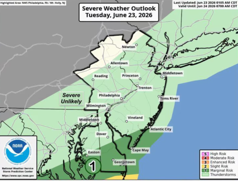
New Jersey is expected to face a period of active weather on Tuesday as rising temperatures combine with the risk of strong to severe thunderstorms across parts of the state. Weather experts are also warning about damaging wind gusts that could reach up to 60 miles per hour in some areas during the afternoon and evening hours.
According to the National Weather Service, the chance of showers and thunderstorms has increased, especially for regions along and north and west of the I-95 and I-195 corridors. The most active weather window is expected between 2 p.m. and 9 p.m., when storms may quickly develop and intensify.
Forecasters say a few of these thunderstorms could become strong enough to produce damaging winds, which may lead to localized tree damage and brief power disruptions. Northwestern New Jersey currently falls under a slight risk category for severe weather, which is level 2 out of 5 on the official risk scale.
Alongside the storm threat, temperatures on Tuesday are expected to climb into the low to mid-80s across much of the state. This is noticeably warmer than typical mid-April conditions, signaling an early push of spring warmth.
The heat is expected to intensify further on Wednesday, which could become the warmest day of the week. High temperatures may reach the upper 80s and could even approach 90 degrees in some areas. If this happens, it would mark the first 90-degree reading since early September, highlighting an unusually early warm spell for the region.
Thursday is also expected to remain warm, with highs staying in the mid to upper 80s. However, increased cloud cover may slightly reduce temperatures compared to Wednesday. Weather officials also note that a few isolated afternoon showers or thunderstorms could still develop, mainly in northern parts of the state near and north of the I-78 corridor, though widespread rainfall is not expected.
The ongoing warm pattern may also put pressure on daily temperature records. Several locations, including Newark, Trenton, and Atlantic City, have historical record highs for mid-April that could be challenged if temperatures climb as forecasted.
Residents at the Jersey Shore are expected to experience slightly cooler conditions compared to inland areas. This is mainly due to cold ocean water temperatures and the development of an afternoon sea breeze, which will help limit how high temperatures rise along the coast.
Looking ahead to the end of the week, warm conditions are expected to continue through Friday and Saturday, with highs generally staying in the mid-70s to mid-80s range. However, the weather pattern is forecast to change by Sunday as a cold front moves into the region. This system could bring showers and a chance of thunderstorms, followed by a noticeable drop in temperatures by Sunday night into Monday, bringing readings closer to seasonal averages.
The National Weather Service continues to monitor the situation and advises residents to stay updated on changing forecasts, especially during the peak afternoon and evening hours when storms are most likely to develop.
Sources:
National Weather Service (NWS)