New Jersey Weather Update: Weekend Rain Chances Before Extreme Heat Builds Across the State Next Week
New Jersey residents should prepare for two very different weather patterns over the coming days. Scattered showers and isolated thunderstorms are expected through Saturday and into Sunday, but attention is already turning toward a significant heat wave that could bring dangerous temperatures across the state later next week.
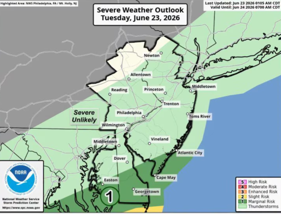
According to the latest forecast from the National Weather Service, a slow-moving cold front will move across the region, creating favorable conditions for periods of rain and a few thunderstorms from Friday night through Saturday. Forecasters say the highest chance of widespread rainfall will be in areas near and south of Interstate 78 during the day on Saturday.
Although isolated thunderstorms may develop during the late afternoon and evening hours, the overall risk of severe weather remains low. Most communities are expected to experience brief periods of rain rather than widespread severe storms.
Saturday’s temperatures are forecast to stay much cooler than recent days, with afternoon highs reaching the upper 70s across much of New Jersey. The cooler temperatures, combined with cloud cover and scattered showers, will provide a temporary break from the hotter conditions expected later in the week.
As Saturday evening progresses, rainfall is expected to gradually become less widespread. However, a few lingering showers may continue into Sunday, especially across southern parts of the state.
Sunday’s forecast calls for improving weather, with increasing sunshine expected during the day. Afternoon temperatures should climb into the low 80s, creating more comfortable conditions for outdoor activities. By Sunday night, the cold front is expected to move farther south, allowing drier air to settle across New Jersey.
The start of the new workweek is expected to bring more stable weather. Monday is forecast to be mostly sunny with afternoon highs ranging from the mid-80s to the upper 80s across much of the state.
Warmer conditions will continue on Tuesday as temperatures approach 90 degrees under mostly sunny skies. While much of the day is expected to remain dry, forecasters say another round of showers and thunderstorms could develop later in the day.
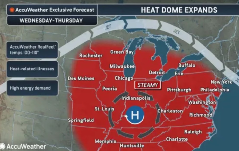
The biggest weather concern arrives during the middle and end of next week.
Beginning Wednesday, temperatures are expected to rise well into the 90s as a strong stretch of summer heat builds over the region. By Thursday and Friday, many parts of New Jersey could experience afternoon highs ranging from the upper 90s to above 100 degrees.
In addition to the high air temperatures, the combination of heat and humidity is expected to push heat index values above 105 degrees in some locations. These conditions can become dangerous, particularly for older adults, young children, outdoor workers, and anyone spending extended time outside.
The National Weather Service indicates that extreme heat warnings may become necessary for large portions of the state if the forecast remains on track. The expected period of dangerous heat could continue for several days, including part of the July Fourth holiday period.
For now, residents should expect an unsettled weekend with scattered showers and isolated thunderstorms before a much hotter weather pattern develops during the second half of next week. While severe storms are not expected to be widespread, the prolonged heat forecast later in the week has the potential to become the most significant weather concern for New Jersey.
Sources
- National Weather Service (NWS)
- National Oceanic and Atmospheric Administration (NOAA)