


New Jersey Faces Another Round of Storms as Heat Index Nears 100 Degrees
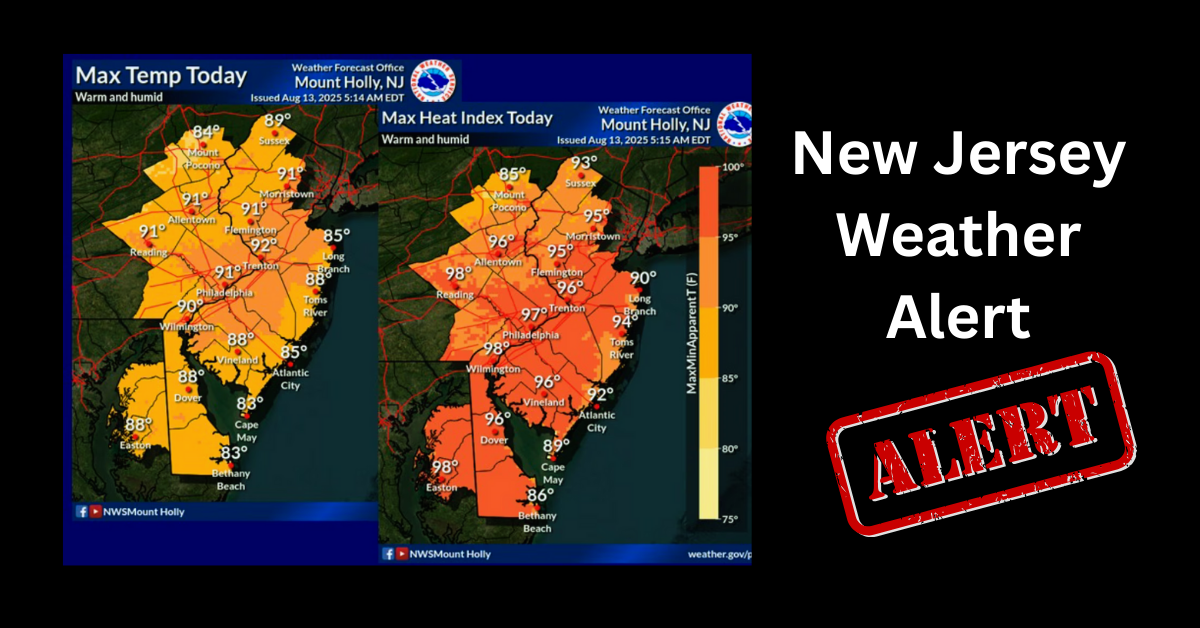
New Jersey residents are heading into another unsettled summer day as a combination of high temperatures, heavy humidity and the possibility of afternoon and evening thunderstorms creates several weather concerns across the state.
The National Weather Service warned Saturday that scattered thunderstorms could develop again, with some storms becoming strong enough to produce damaging wind gusts and periods of intense rainfall. Localised flash flooding is also possible, particularly where heavy rain falls repeatedly over the same area.
The latest forecast comes after thunderstorms moved through parts of New Jersey on Friday, adding to a stretch of uncomfortable and potentially hazardous summer weather. The combination of lingering moisture in the atmosphere and daytime heating can provide enough energy for thunderstorms to quickly strengthen during the afternoon and evening.
For residents, the main concern is not that every part of New Jersey will experience severe weather. Instead, forecasters are highlighting the possibility that some locations could see brief but intense storms while nearby communities experience little or no rain. This uneven pattern is common with scattered summer thunderstorms and can make conditions change quickly from one neighbourhood to another.
Heat will remain another major part of Saturday’s forecast. The National Weather Service’s New York office said hot and humid conditions would persist, with heat index values reaching the mid-to-upper 90s in parts of northeastern New Jersey. A heat advisory remained in effect for several New Jersey counties through Saturday evening.
The heat index is important because it measures how hot the weather feels when humidity is taken into account. Even when the actual air temperature is below 100 degrees, high humidity can make outdoor conditions feel much hotter. That can increase the risk of heat-related illness, especially for people who spend long periods outside, older adults, young children and people working in the heat.
The timing of the storms also matters. Afternoon heating can help thunderstorms develop after temperatures climb during the day. Some storms may continue into the evening. Because thunderstorms can form and intensify quickly, residents should not assume that a quiet morning means the rest of the day will remain calm.
Heavy rainfall is one of the biggest concerns associated with Saturday’s storms. A thunderstorm does not have to last for hours to cause flooding. A short period of very heavy rain can overwhelm storm drains, flood low-lying roads and create dangerous conditions in areas that have already received substantial rainfall.
Flash flooding can be especially dangerous because water levels can rise rapidly. Drivers should never attempt to cross a flooded roadway simply because the water appears shallow. It can be difficult to determine the actual depth of the water, and moving water can affect a vehicle’s ability to maintain traction.
Strong winds are another possible threat. The National Weather Service said some storms could produce damaging wind gusts. Powerful thunderstorm winds can bring down tree branches, damage property and cause power outages by affecting electrical lines.
The risk is particularly important for communities that were already dealing with the effects of recent storms. Utility crews have been working to restore electricity after earlier weather-related outages, while additional thunderstorms can create new problems for the electrical system.
PSE&G reported that additional storms during the week had caused new outages and said crews had restored tens of thousands of customers affected by those storms. The utility also maintains an outage map for customers who need current restoration information.
Saturday’s weather could therefore create a difficult combination for residents: oppressive heat during the day, followed by the possibility of sudden thunderstorms and heavy rain. People without electricity may also face additional discomfort if temperatures remain high and air conditioning is unavailable.
Residents should take precautions before storms arrive rather than waiting until severe weather is already overhead. Outdoor activities should be planned with the forecast in mind, and people should be prepared to move indoors if thunder is heard or weather conditions deteriorate.
Anyone spending time outside should also take the heat seriously. Drinking water regularly, taking breaks in cooler locations and avoiding unnecessary strenuous activity during the hottest part of the day can help reduce the risk of heat-related illness.
People who live in areas prone to flooding should also keep an eye on changing weather conditions and be prepared to move to higher ground if authorities issue a flood warning. A flood watch means conditions are favourable for flooding, while a warning means flooding is occurring or is expected to occur, and immediate action may be necessary.
Motorists should use extra caution if thunderstorms develop while they are travelling. Heavy rain can sharply reduce visibility and make roads slippery, while water can collect quickly on streets and highways. If a roadway is flooded, the safest decision is to turn around and find another route.
Drivers should also be alert for fallen branches, debris and traffic signals that may stop working after strong winds. Even after a storm passes, hazards can remain on roads and around homes.
Residents should rely on official weather alerts for the most current information because the exact location and strength of thunderstorms can change during the day. The National Weather Service provides updated forecasts, watches and warnings as conditions develop.
Saturday’s forecast is another reminder that summer weather in New Jersey can bring several hazards at the same time. High heat and humidity can create health concerns, while thunderstorms can bring damaging winds, intense rainfall and localised flooding within a relatively short period.
The weather is expected to remain warm beyond Saturday, although the National Weather Service said humidity should gradually decrease during the following days. That means residents may get some relief from the oppressive humidity even as hot conditions continue.
For now, the safest approach is to stay informed, limit unnecessary exposure to the heat and be ready to move indoors if thunderstorms develop. Because scattered storms can be highly localised, residents should pay attention to conditions in their immediate area rather than relying only on the forecast for a nearby city.
New Jersey’s weather on Saturday may not be a washout statewide, but the combination of heat, humidity and potentially strong thunderstorms means conditions could change quickly. Keeping phones charged, monitoring official alerts and knowing where to take shelter can help residents respond safely if severe weather develops.
Sources
National Weather Service, National Oceanic and Atmospheric Administration
PSE&G, New Jersey Public Service Electric & Gas

