Foggy Start for New Jersey Saturday With Storms Expected Overnight Before a Warmer Week Ahead
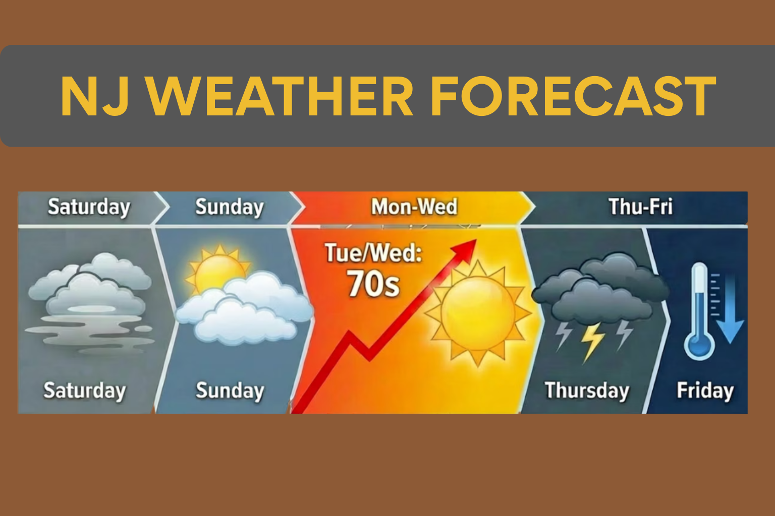
New Jersey forecasters expect an overcast and foggy morning on Saturday, with thunderstorms possible later tonight before the weather improves on Sunday. Forecasters expect calmer sky and milder temperatures over the weekend after a stormy start.
Several counties in the state have morning dense fog advisories from the National Weather Service. Atlantic, Cape May, Monmouth, Ocean, and southeastern Burlington counties are under advisories until 10 a.m. Fog may hinder morning travel, especially in coastal and southern areas.
Forecasters predict fog to steadily lift throughout the day, but gloomy skies will persist across much of the state on Saturday. Most of New Jersey will see daytime highs in the mid-40s to low 50s.
Meteorologists say fog may improve later in the day, but cloud cover will likely persist. Due to gloomy conditions and the possibility of storms later in the evening, weather experts recommend Sunday for outdoor activities this weekend.
Saturday night’s warm front will modify conditions. After this weather pattern change, nocturnal temperatures will rise instead of decline. A cold front will trail milder air, bringing showers and thunderstorms.
Storms may form late Saturday night and last until Sunday morning. As the cold front passes, showers and thunderstorms may bring strong winds. Overnight rain, thunder, and high gusts are possible in some areas.
Weather should improve by Sunday as the storm system moves away. Today, skies will clear, raising temperatures from Saturday. Forecasters predict afternoon highs in the mid 50s to low 60s for much of New Jersey.
The region will warm up early next week after Sunday’s improvement. More sunlight and rising temperatures are forecast Monday. Due to maritime winds from the still-cold Atlantic waters, Jersey Shore locales may stay in the 50s while inland areas reach the 60s.
Even warmer air is forecast Tuesday and Wednesday. Inland New Jersey could reach the low to mid-70s during this time. Though chilly, coastal communities will still be milder than at the weekend.
Historically, this time of year has seen abnormally warm temperatures. In 2016, Newark hit a record high of 81 degrees on March 11. The March 12 record high was 75 degrees in 2021. The next warm period may not reach record levels, but it will be a big difference from the cooler weekend weather.
The warmer pattern is predicted to end soon. Another powerful cold front is expected late Wednesday into Thursday, according to meteorologists. This system could bring more showers and thunderstorms to sections of the state.
After that system passes, temperatures should revert to seasonal norms. Many locations might see daytime highs drop into the lower to mid-40s by the end of next week, marking a return to cooler early-spring weather in New Jersey.
For now, folks across the state should expect low visibility early Saturday, gloomy skies during the day, and thunderstorms overnight. On Sunday, conditions will progressively improve, followed by a brief warmup before another weather system comes later in the week.