New Jersey Braces for Late-December Winter Storm With Snow, Sleet, and Ice
New Jersey residents are prepared for a major winter storm that might disrupt travel and life after the holidays. Forecasters expect snow, sleet, and freezing rain from Friday until early Saturday, but a white Christmas seems improbable.
Northern New Jersey may get 3–6 inches of snow, while southern counties may get 1–3 inches. Sleet and ice may accompany snow, depending on temperature and storm path. Ice-covered roadways in eastern Pennsylvania and western New Jersey.
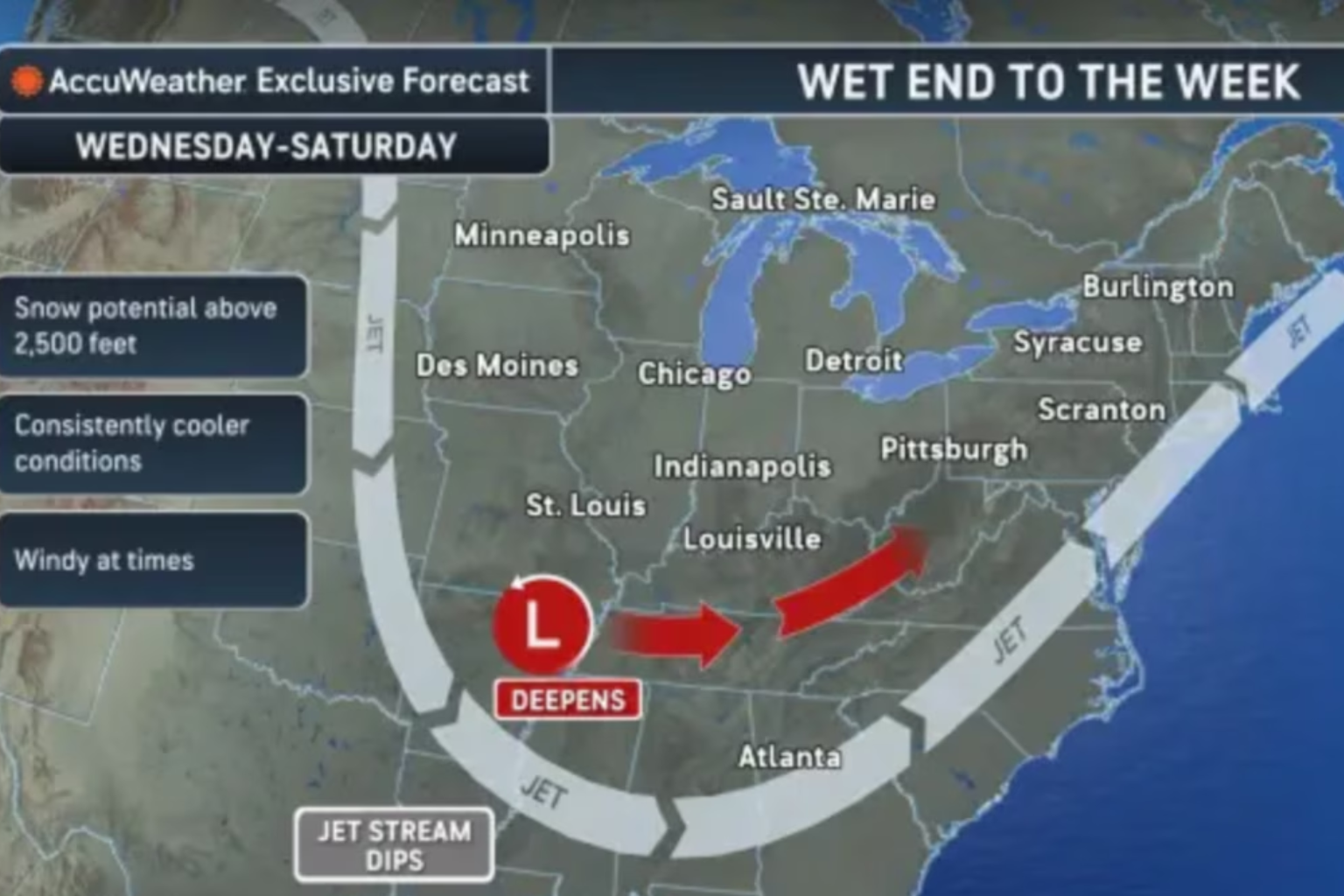
NWS: Air temperature strata complicate storm forecasting. Warmer air may lessen snowfall in cold areas. Rain, sleet, freezing rain, and snow are nearby in this transition zone. Snow and ice depend on low-pressure system timing and direction.
Northeastern New Jersey and NYC may get 3 inches or more snow from 50 to 90%. Small storm track changes can dramatically affect precipitation and rain, says the NWS.
New Jersey may expect strong gusts on Tuesday night and Wednesday, especially Christmas Eve, before the winter storm. Southeast winds 25–30 mph, northwest 30–40. By Wednesday afternoon, winds should calm, but icy conditions later in the week could disrupt traffic and power.
Officials advise passengers to check weather updates, allow extra time, and prepare for snow and ice. Drive carefully on bridges and overpasses where ice may form first.
This late-December storm reminds us that New Jersey winters are unpredictable and require safety planning. Residents should expect icy roads and power outages and be informed as the storm approaches.
Sources:
National Weather Service, New Jersey Office
AccuWeather