Severe Storm Threat Prompts Tornado Watch Across Much of New Jersey Monday
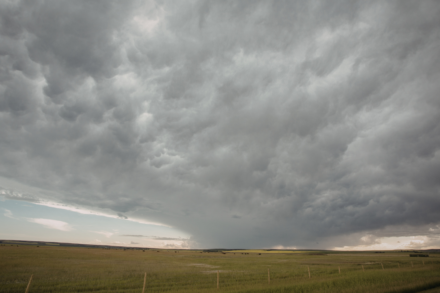
Forecasters cautioned that strong thunderstorms passing through the area could create circumstances conducive to tornado development later in the day, thus residents throughout most of New Jersey were placed under a tornado watch on Monday.
The National Weather Service, working with the Storm Prediction Center, issued the tornado watch on Monday at 11:30 a.m. The state’s 16 counties are covered by the alert, which is in force until 7 p.m.
Meteorologists say that almost all of New Jersey is under watch, save for the counties of Bergen, Essex, Hudson, Passaic, and Union. The alert was issued, according to officials, because weather patterns that are forming in neighboring states are approaching the area and could get stronger as they get closer.
When there is a tornado watch, the weather is conducive to the production of tornadoes. It indicates that the atmosphere may support spinning storm systems that can create funnel clouds that could reach the ground, but it does not indicate that a tornado has already formed.
Strong thunderstorm activity has already begun to move across regions west and south of New Jersey, according to weather specialists. Heavy rain, tiny hail, and strong wind gusts are just a few of the extreme weather conditions that those storm systems may bring to the state.
Forecasters cautioned that in certain places, these wind gusts might be powerful enough to pull down trees or power lines. In regions that are receiving more rainfall, sudden downpours may also result in localized floods and brief periods of limited visibility.
During a tornado watch, officials advise locals to remain vigilant and keep a careful eye on weather updates throughout the afternoon and evening. Warnings are only given when a tornado has been identified or is likely to occur, whereas watches signal possible danger.
Authorities advise people to seek safe cover inside a sturdy building right once if a tornado warning is issued for any location. The safest course of action in a tornado emergency is to avoid windows and take shelter in an interior room or basement.
According to meteorologists, the first thunderstorms may start to show up in some areas of New Jersey as early as 2:00 PM on Monday. However, later in the evening is when severe weather is most likely to occur.
According to the National Weather Service, the highest storm activity might occur between 5 and 11 p.m., when storm movement and air instability could raise the possibility of severe weather.
As the storms pass across the area, emergency officials advise locals to keep weather alerts turned on on their phones and to be ready for quickly changing conditions.