
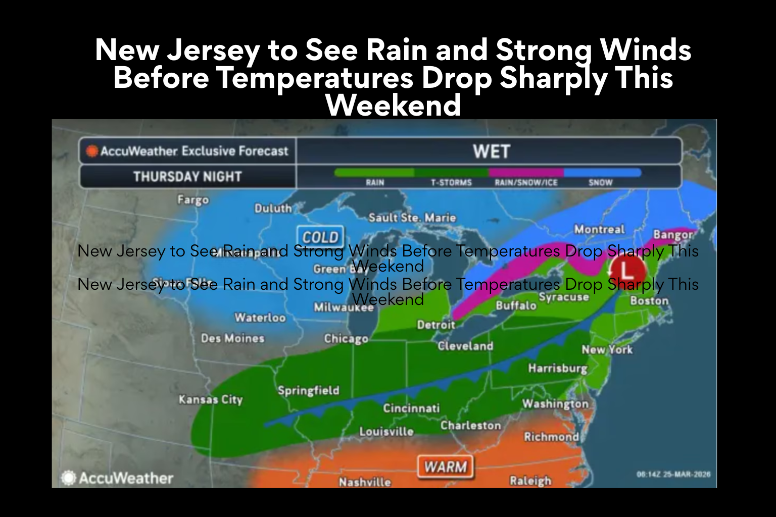
New Jersey to See Rain and Strong Winds Before Temperatures Drop Sharply This Weekend
As a powerful weather system rolls into the area late Thursday, bringing with it rain, gusty winds, and a dramatic drop in temperatures heading into the weekend, a period of calm and progressively warmer weather is predicted to change over New Jersey.
With temperatures rising into the mid to upper 50s on Wednesday over much of the state, midweek conditions are still comparatively moderate. Light southwest winds will continue to blow gently, and the skies are predicted to remain partly to mostly cloudy. Temperatures are expected to increase even further on Thursday, reaching into the 60s and possibly low 70s in some places, but this steady pattern will only last for a short while.
This warming trend won’t last long, though. There will be a noticeable change in the weather on Thursday night with the arrival of a powerful cold front. Winds will intensify considerably ahead of the front, with gusts predicted to reach 25 to 35 miles per hour. As the system gets closer, these windy conditions will emerge during the day on Thursday and last into the evening.
By Thursday night, rain is expected to start in the northwest of New Jersey and move throughout the remainder of the state overnight. Most places are predicted to receive between a quarter and half an inch of precipitation as the rain continues into Friday morning. There is a possibility of scattered thunder as the front passes through, but widespread severe weather is not expected.
The rain should stop by Friday afternoon, but the effects of the cold front will be more apparent. The day may begin in the 50s, but as cooler air moves into the area behind the system, temperatures are predicted to gradually drop.
Temperatures will be well below normal for late March as the cooling trend continues into the weekend. In stark contrast to the pleasant weather earlier in the week, Saturday’s daytime highs are predicted to stay only in the 40s. It is predicted that Friday and Saturday’s overnight temperatures will drop dramatically, to the mid-20s to low 30s, making the mornings cooler than typical.
The weekend itself is predicted to stay dry despite the temperature decline, with no more rain expected until early next week. The brief but significant weather system that moves through late Thursday and early Friday will be followed by a change to cooler and more stable temperatures.
All things considered, residents of New Jersey can anticipate a discernible shift from warm spring-like weather to a colder pattern in a little amount of time, underscoring the region’s normal late March circumstances’ variability.
Sources
National Weather Service
AccuWeather