
Light Snow Possible in North Jersey Overnight, Forecasters Watching Uncertain Storm for Late Weekend
Light snow is expected late Friday night into early Saturday in northern New Jersey. While major snowfall is unlikely, forecasters warn that chilly temperatures could make untreated roads and sidewalks slick by early Saturday morning.
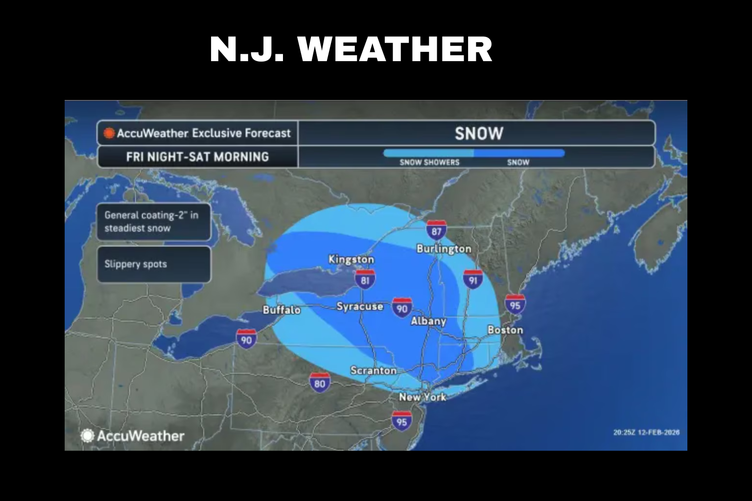
Overnight, the National Weather Service predicts a weak clipper-type cyclone will travel quickly through the region. This fast-moving system will mostly affect locations north of Interstate 78. Most communities will receive only a few tenths of an inch of snow. As the system passes, some places may remain dry.
Even with modest precipitation, overnight temperatures in the teens and low 20s could make travel slippery. In cold weather, even little amounts of snow can freeze quickly on untreated surfaces. Early Saturday drivers should be cautious on bridges, overpasses, and side routes.
As snow showers end and drier air arrives Saturday morning, conditions should improve. Saturday should be dry with slightly lower temperatures than Friday. Upper 30s in northern New Jersey and mid-40s in the south are expected.
Friday will be cool and quiet. Daytime highs will be in the 30s under mainly sunny skies. Although it’s cold, a northwest wind will gradually quiet down throughout the day.
On Sunday and Monday, another system may bring rain. Currently, coastal New Jersey is most likely to be affected. Overall, substantial snowfall is unlikely. Forecasts indicate that most of the low-pressure system will track south of New Jersey, reducing damage.
Meteorologists warn that this late-weekend storm’s route is unknown. Parts of the state may get rain, snow, or a brief wintry mix as the system evolves. A warmer air mass forecast ahead of the system enhances the likelihood of rain rather than snow in many places, however some communities may initially experience a rain-snow mix.
By early next week, temperatures should moderate. Some coastal areas may reach 50 degrees, while most of the state will reach the 40s. Overnight lows, which have been below freezing, should progressively rise. New Jersey’s snow cover should melt gradually due to this warming trend.
Another weather system may deliver rain north of the Pennsylvania Turnpike and Interstate 195 corridor by midweek. Impacts are projected to be minimal across most of the state.
Residents should monitor forecast updates even though no major snow storm is likely. Light nighttime snow and freezing temperatures may cause short-term traffic issues, and the late-weekend system is unknown. Staying informed and planning ahead will help ensure safe travel throughout severe cold weather.
Sources:
National Weather Service
AccuWeather