Cold Snap Tightens Grip on New Jersey with Back-to-Back Freeze Alerts and Chilly Weekend Ahead
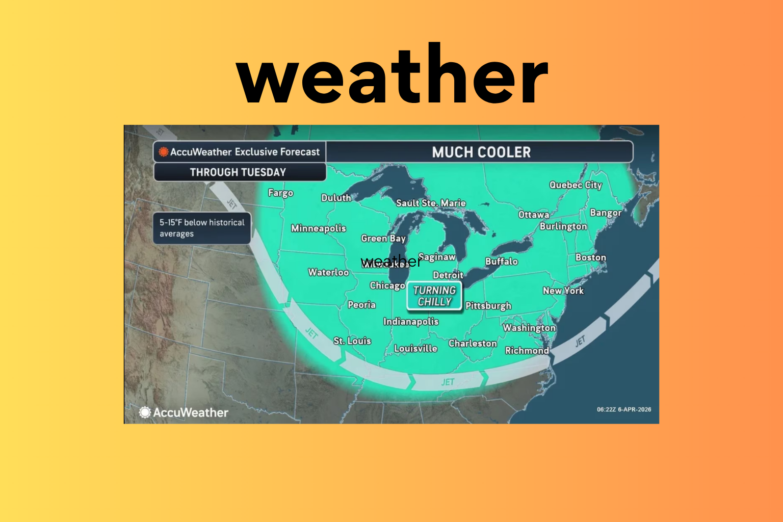
New Jersey is heading into a stretch of unseasonably cold weather, with widespread freezing temperatures expected over the next two nights. Officials have issued freeze warnings and watches across multiple counties as temperatures fall well below normal for early April, raising concerns for crops, plants, and outdoor infrastructure.
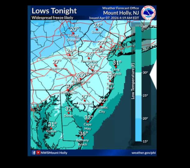
According to the National Weather Service, at least 13 counties will experience freezing conditions from Tuesday night into Wednesday morning. Overnight temperatures are forecast to drop into the low 20s to low 30s statewide, creating a risk for frost and freeze damage. Southern counties, where the growing season has already begun, are among the most affected. These include Atlantic, Burlington, Camden, Cape May, Cumberland, Gloucester, Mercer, Monmouth, Ocean, and Salem counties.
In addition, a freeze watch has been issued for parts of northern New Jersey, including Hudson County and eastern sections of Essex and Union counties. Weather officials have warned that these conditions could harm sensitive vegetation and crops while also posing a threat to unprotected outdoor plumbing systems.
The cold air mass will be accompanied by breezy conditions on Tuesday, with winds ranging from 15 to 20 miles per hour and gusts reaching up to 35 miles per hour. The day may begin with scattered showers, and in northern areas, there is a chance that precipitation could mix with sleet or even wet snow before tapering off.
As the day progresses, humidity levels are expected to drop significantly, increasing the risk of fire spread despite the cooler temperatures. Afternoon highs will struggle to reach comfortable levels, staying in the upper 40s to low 50s, which is several degrees below the seasonal average.
The cold intensifies again Tuesday night as temperatures fall sharply into the mid-20s to low 30s. By Wednesday, conditions will remain cold but dry, with sunny skies offering little relief as daytime highs hover between the mid-40s and around 50 degrees. Winds will ease slightly, ranging from 5 to 10 miles per hour.
Another round of freezing temperatures is expected Wednesday night, with early evening frost likely to develop across much of the state. The southern half of New Jersey remains under a freeze watch extending into Thursday morning, signaling continued concern for agricultural areas and homeowners alike.
A gradual warming trend is expected to begin on Thursday, with daytime temperatures climbing into the 50s. However, nighttime conditions will still be cool, with lows dipping into the mid-30s, meaning frost risks may persist in some areas.
Residents are advised to take precautions during this period of extended cold, especially those with gardens, farms, or exposed plumbing. The return to warmer conditions later in the week will provide some relief, but the immediate focus remains on managing the impact of these back-to-back freezing nights.
Sources:
National Weather Service